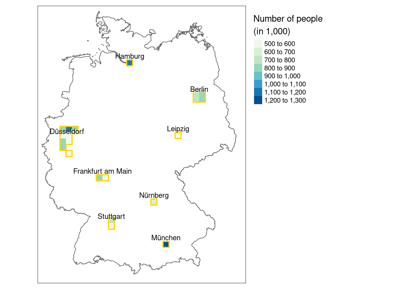
14.4 Define metropolitan areas
We define metropolitan areas here as pixels of 20 km2 inhabited by more than 500,000 people
pop_agg <- terra::aggregate(reclass$pop, fact = 20, fun = sum, na.rm = TRUE)

pop_agg <- pop_agg[pop_agg > 500000, drop = FALSE]

summary(pop_agg)
## pop
## Min. : 510335
## 1st Qu.: 586917
## Median : 782416
## Mean : 771034
## 3rd Qu.: 823811
## Max. :1204870
## NA's :1431metros <- pop_agg |>
terra::patches(directions = 8) |>
terra::as.polygons() |>
sf::st_as_sf()
metros$names = c("Hamburg", "Berlin", "Düsseldorf", "Leipzig",
"Frankfurt am Main", "Nürnberg", "Stuttgart", "München")
metros_points <- st_centroid(metros)## Warning: st_centroid assumes attributes are constant over geometriestm_shape(pop_agg/1000) +
tm_raster(palette = "GnBu",
title = "Number of people\n(in 1,000)") +
tm_shape(ger) +
tm_borders() +
tm_shape(metros) +
tm_borders(col = "gold", lwd = 2) +
tm_shape(metros_points) +
tm_text(text = "names", ymod = 0.6, shadow = TRUE, size = 0.75,
fontface = "italic") +
tm_layout(legend.outside = TRUE, legend.outside.size = 0.3)
We could also reverse geocode for the city names
metro_names <- sf::st_centroid(metros, of_largest_polygon = TRUE) |>
  tmaptools::rev_geocode_OSM(as.data.frame = TRUE) |>
  select(city, town, state)
## Warning: st_centroid assumes attributes are constant over geometriesmetro_names <- dplyr::mutate(metro_names, city = ifelse(is.na(city), town, city))
metro_names## city town state
## 1 Hamburg <NA> <NA>
## 2 Berlin <NA> <NA>
## 3 Velbert Velbert Nordrhein-Westfalen
## 4 Leipzig <NA> Sachsen
## 5 Frankfurt am Main <NA> Hessen
## 6 Nürnberg <NA> Bayern
## 7 Stuttgart <NA> Baden-Württemberg
## 8 München <NA> Bayern