7.2 Example: North Carolina
## Reading layer `nc.gpkg' from data source
##   `/home/runner/work/_temp/Library/sf/gpkg/nc.gpkg' using driver `GPKG'
## Simple feature collection with 100 features and 14 fields
## Geometry type: MULTIPOLYGON
## Dimension:     XY
## Bounding box:  xmin: -84.32385 ymin: 33.88199 xmax: -75.45698 ymax: 36.58965
## Geodetic CRS:  NAD27
7.2.1 Subsetting
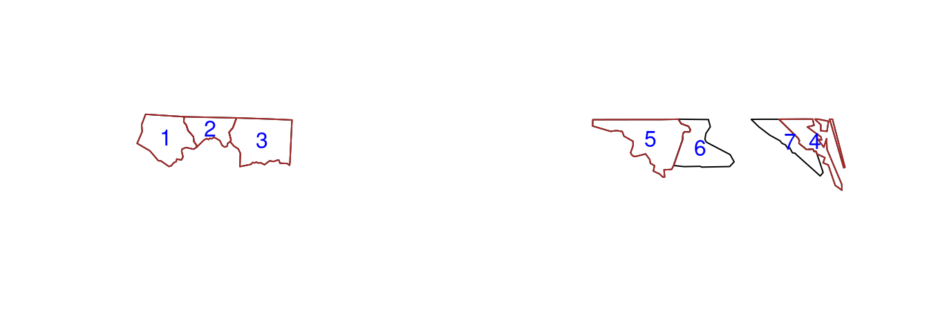
subset of North Carolina
Code
nc5 <- nc[1:5, ]
nc7 <- nc[1:7, ]
plot(st_geometry(nc7))
plot(st_geometry(nc5), add = TRUE, border = "brown")
cc = st_coordinates(st_centroid(st_geometry(nc7)))
text(cc, labels = 1:nrow(nc7), col = "blue")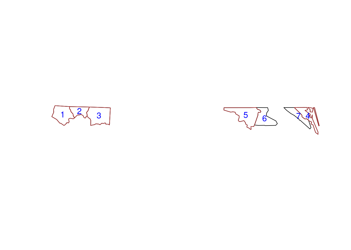
- the
dropargument is by defaultFALSEmeaning that the geometry column is always selected - selection with a spatial (
sf,sfc, orsfg) object as first argument leads to selection of the features that spatially intersect with that object
## Sparse geometry binary predicate list of length 5, where the predicate
## was `intersects'
##  1: 1, 2
##  2: 1, 2, 3
##  3: 2, 3
##  4: 4, 7
## 5: 5, 6## [,1] [,2] [,3] [,4] [,5] [,6] [,7]
## [1,] TRUE TRUE FALSE FALSE FALSE FALSE FALSE
## [2,] TRUE TRUE TRUE FALSE FALSE FALSE FALSE
## [3,] FALSE TRUE TRUE FALSE FALSE FALSE FALSE
## [4,] FALSE FALSE FALSE TRUE FALSE FALSE TRUE
## [5,] FALSE FALSE FALSE FALSE TRUE TRUE FALSE## [1] "sgbp" "list"## [1] as.data.frame as.matrix coerce dim initialize
## [6] Ops print show slotsFromS3 t
## see '?methods' for accessing help and source code